Henrico County Historical Society
PO Box 90775 Henrico, VA 23273 (804)501-5682 hchsinfo@yahoo.com
Open by appointment only

Henrico County Historical Society |
|
|
| Home | Henrico | Maps | Genealogy | Preservation | Membership&Contribution | Shopping | About HCHS |
|
2026 News
|
President's Message
In spite of snow, ice, 90 to 100 plus degree temperatures and air quality alerts from forest fires in Canada, the annual book drive for children (in partnership with the Lakeside Farmers Market) on behalf of the Henrico Christmas Mother was a success! Much to be said of the tenacity of our volunteers, Tinky Keen and Mary Ann Soldano for staffing the collection table for "Christmas in July". We were pleased to also accept monetary donations for the Henrico Christmas Mother from those who support our efforts to encourage children to read. Many thanks to Christ Lutheran Church for participating in the book drive again this year and to Highland Springs Methodist Church for the donation of Bibles which was a special request for Seniors and Adults with disabilities which the Henrico Christmas Mother also serves. The Highland Springs Methodist Church building, located on N. Holly Street (ca. 1909) is included in the Inventory of Early Architecture, County of Henrico, Virginia. The church membership dissolved and joined another church. We are pleased to report, a new church congregation has agreed to move into the building, preserving the historic landmark. We thank all who donated and for those of you who missed the opportunity, it is not too late. Santa will not arrive until December. Book donations can be brought to the next quarterly meeting to be held at the Fairfield Library on September 13th. On the subject of historic preservation, we received the following message from "a small local history and outdoor group for kids and teens, mostly young people and their parents getting curious about the stories behind our town, its old buildings, local parks, and landmarks for the first time. We came across the Henrico County Historical Society's website while putting together materials for our group, and it has been a really useful find, especially the photos of the historic properties across Henrico County's districts . . . It is good to know of young people interested in history and preservation in fulfilling our mission: "Preserving the past in the present for the future." We continue our USA 250th celebratory year. You may recognize the speaker for our September 13th meeting, Chris Yohn. He is a past president of the Richmond Chapter of the Sons of the American Revolution, recipient of the SAR Patriot Medal and Gold 25th Anniversary of the American Revolution Medal. We were honored to have Chris participate in the HCHS 50th anniversary celebration in 2025 at Wilton House Museum. He will speak with us this time about his book "Liberty's Land". Liberty's Land tells an amazing story of courage, espionage, conspiracy, murder and the pursuit of liberty. Sounds very intriguing, doesn't it? Henrico County libraries do not allow book sales. Information on how to purchase the book can be found on the HCHS website at Henrico County (Virginia) Historical Society - Shopping We look forward to seeing you there! We continue our USA 250th celebratory Sarah Pace A Note of Thank You from Sharon and Peter Francisco
September Quarterly MeetingCome join us for our third quarterly meeting of the year.
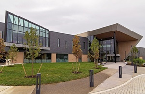
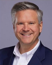
Author Chris Yohn will discuss Liberty's Land, an amazing story of courage, espionage, conspiracy, murder and the pursuit of liberty. We look forward to seeing you there! Christopher Yohn, Author of Liberty's Land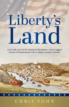
Liberty's Land is available at Amazon and Masthof Press. Mr. Yohn will be happy to sign your copy. America 250th Quilt!We're celebrating America's 250th by offering a chance to win what could become an heirloom quilted throw made by Debbie Shuck and machine quilted by Susan Caldwell. Just buy a ticket for $1.00 (6 for $5.00). Drawing to be held December 6, 2026. You do not need to be present to win. Proceeds to benefit the Henrico County Historical Society Education Fund. Please call (804) 839-2407 for additional information. Tickets available at participating festivals or HCHS meetings. 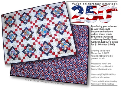
Inventive HenricoansAlthough such a bridge never crossed the Chickahominy or any other rivers in this area or elsewhere, William James' patent for "Improvement in Bridges" seems appropriate for this issue. It appears that at the time he received the patent, he was a U.S. Collectors of Internal Revenue and later postmaster at Ashland. 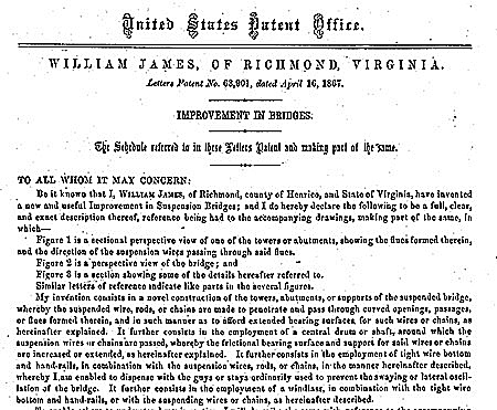
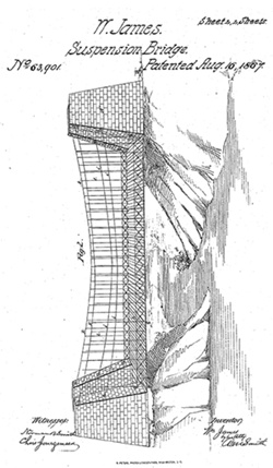
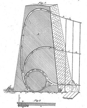
Since the early Eighteenth Century, Henricoans have been . . . Bridging the ChickahominyI'm drawn to water and roads, and in these pages I've gone down Henrico's Little and Big Westham Creeks and Upham Brook, cruised the Kanawha Canal on the Dolly Varden, visited Bosher's Dam in the James River, and even taken a side trip to the spring off Masonic Lane that produced Como Springs Lithia Water in the Nineteenth Century. I've also followed Brook, Osborne and Mechanicsville Turnpikes as well as Three Chopt Road. And where roads met the James River, I rode the various ferries that enabled the crossing. Now, there's another river to cross, the Chickahominy. Named after the Native American tribe and forming Henrico's northern border, it did not in most places present the daunting barrier to crossing as did the James. Chickahominy meant "people of the coarse-pounded corn" (as in hominy grits), and they had built bridges that, of course, predated those of the English settlers. When John Smith and his men attempted to cross Leigh Creek in Lancaster County over one such bridge, it sagged so low that Powhatan's people took pity on them and removed them in a canoe, causing Smith to refer to it as a "dreadful bridge." Clearly, the colonists needed better bridges, and the General Assembly addressed that need. Hening's Statutes at Large records that it ordered the following: "WHEREAS for the more ease of travellers, It was enacted by the Assembly in jan. 1641, that all this countrey respectively provide and maintain fferrys and bridges . . . And where one creeke parts two counties, there each of them to contribute towards the maintenance of the said fferries, and bridges" (Vol. 1, p. 269). Early bridges over the Chickahominy: Joshua Fry and Peter Jefferson's 1751 Map of the Inhabited Part of Virginia containing the whole Province of Maryland, with Part of Pensilvania, New Jersey and North Carolina shows the locations of Bottoms Bridge and Meadow Bridge. More information about these two bridges appear after the image below. 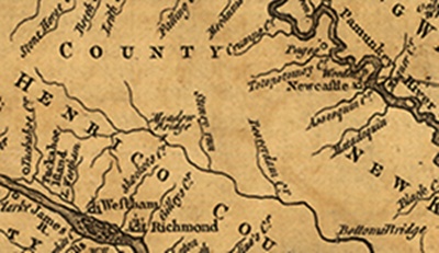
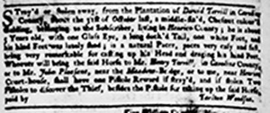
Meadow Bridge, upriver from Bottoms Bridge, is the only other Henrico County bridge over the Chickahominy to appear on the 1751 Fry-Jefferson map of Virginia and Maryland; and by the time of the American Revolution the bridge was in need of attention. In his September 11, 1781 letter to Governor Nelson, Col. John Seymour noted that because of his responsibility of, among other things, "Rebuilding the Meadow-Bridges" he could only spare 100 men from his command because "Besides the Meadow & L. Pages Bridges, the Last Great Rains within these Few days have Demolish'd the Lesser Bridges, Mill Dams & gullied the Hills in such a manner that is scarcely possible for any Carriage to pass" (Calendar of Virginia State Papers and Other Manuscripts, Vol. II, pp. 460-61). And by 1786, the bridge needed some additional attention to enable passage up to that point. The 11 October 1786 General Assembly named eleven trustees (William Douglass, Daniel Trueheart, Julius Allen, Miles Selden, William Macon, William Lewis, William Christian, Richmond Terrel, Joseph Vaiden, William Carter, and John Price) and directed that "they are hereby nominated, constituted, and appointed trustees, for clearing and extending the navigation of the said river, as far up the same as the Meadow Bridges, and they are hereby authorised and empowered, to take and receive subscriptions for that purpose." The two bridges also served as landmarks for travelers, often for those who had lost something or had something stolen as seen in the announcements from the Virginia Gazette 10 July 1779: 
Although that bridge was not erected, the curious name of the meadow provides an example of the confusion that often surrounds early historical documents and records. Jeffrey O'Dell's Inventory of Early Architecture and Historic Sites identifies it as "Pickinocky" or "Picquinoque" or "Picquenocky," placing it "on the eastern side of the Richmond-Henrico Turnpike along the Chickahominy Bluffs." The sale of "a valuable tract of land known as Pickenocky" appearing in the Virginia Gazette of 14 October 1773 provides a different location, as seen below: 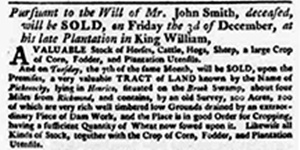
Winston's Bridge (seen on 19th century map on the opposite page) was the subject of An act for establishing a new boundary line between the counties of Henrico and Hanover The boundary line between the two counties needed clarifying. The act read, "WHEREAS the main run of Chickahominy-Swamp hath been by law established as the boundary-line between the counties of Henrico and Hanover, which, from various causes, if formed into a variety of streams, so that the main run cannot at this time be ascertained with precision; Be it therefore enacted by the General Assembly, That the courts of the said counties who shall act upon oath, and they, or a majority of them, are hereby empowered and required to proceed to chop a line of marked trees, to begin at the place where the New Kent line corners on the swamp, and run up the said swamp to the place where a bridge formerly stood, commonly called and known by the name of Winston's bridge, opposite the land late the property of Peter Winston, deceased." Winston had obviously been a respected landholder in the county as evidenced by his election to a committee of safety, which included a number of other important county citizens. Below is from the Virginia Gazette, 14 October 1773. 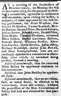
This story of the county's bridges over the Chickahominy has looked at those of the 1700s, and it turned out to be more than a story of just bridges. Many bridges crossed that river in the ensuing years, and we'll cross those bridges when we come to them in future issues. Joey Boehling Two Chickahominy Bridges in the Civil WarHare's Map of the Vicinity of Richmond and Peninsular Campaign in Virginia, 1862 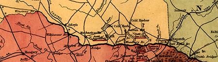
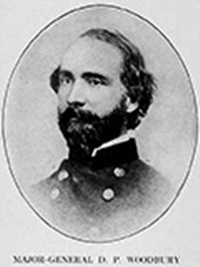
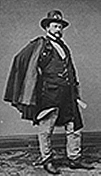
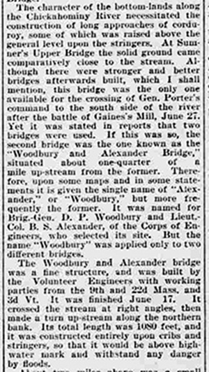
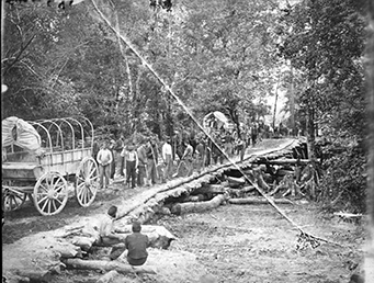
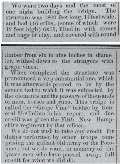
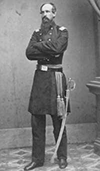
Woodbury & Alexander Bridge: The bridge below was built by Brigadier General. Daniel Phineas Woodbury and Lieutenant Colonel B. S. Alexander. Below the image of the bridge, Woodbury is pictured left, and Alexander is pictured right. 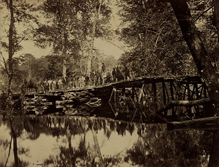
Now You Know'Avalanche' Prevention Congratulations to Nancy Grubbs, Margaret Thomas and Mary Jo and Haywood Wigglesworth for correctly identifying the "What Do You Know?" objects in the previous newsletter as snow guards. 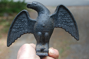
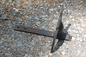
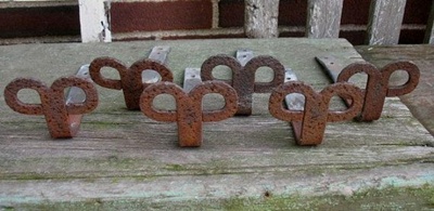
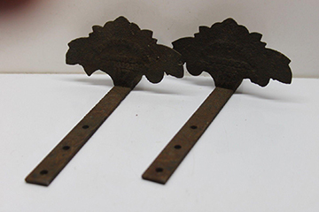
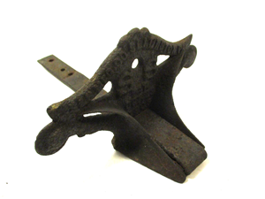
The idea was to prevent large packs of snow and ice sliding down and off the roof, a danger to people and plantings below. And we've included a selection of other antique snow birds. 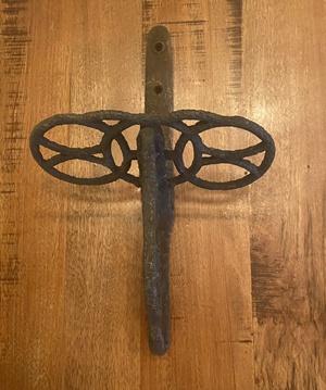
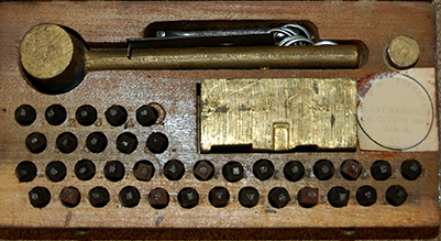
What Do You Know?This green wooden "box" measures 4 x 8 x 4 inches. The raised block inset in the base is metal. The brass hooks keep the box from opening and spilling the contents. Text within the circle on the white label has been obscured because it given away the box's purpose. Email your answers to jboehling@verizon.net. We look forward to hearing from you. 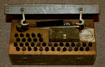
|
| |